The Invisible Crisis
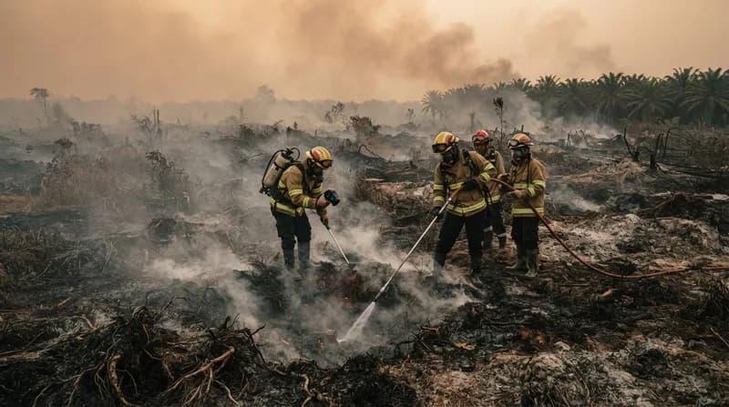
As Indonesia enters the 2026 fire season, the nation is confronting an environmental phenomenon that is far more stubborn and hazardous than typical forest wildfires. Unlike traditional blazes that consume tree canopies and brush, these fires are burning underground. Fed by vast, dried-out deposits of peat—a dense, carbon-rich soil found in tropical wetlands—these smoldering fires operate at lower temperatures but persist for months, releasing massive quantities of pollutants, including fine particulate matter, methane, and sulfur dioxide.
The current situation is exacerbated by the convergence of a strengthening El Niño and a severe drought that has left nearly 90 percent of Indonesia with little to no rainfall. This climate-driven drying has rendered normally water-logged landscapes highly combustible, turning ancient carbon-storing peatlands into long-burning, underground furnaces that will likely continue to smolder until the arrival of the rainy season in October or November.
The Limits of Satellite Surveillance
Monitoring these fires has proven to be a significant technological challenge. While instruments like MODIS and VIIRS, mounted on NASA and NOAA satellites, provide near-real-time thermal anomaly detection, they are not infallible. Paradoxically, the most intense and dangerous fire events often produce smoke so thick that it obscures the satellite's view, causing a drop in detected hotspots even as the scale of the disaster intensifies. Because these fires burn beneath the forest canopy and deep within the peat, they frequently remain hidden from conventional optical and infrared sensors.
To combat this, research teams are now looking toward more advanced methods, utilizing shortwave infrared observations from the Landsat and Sentinel-2 satellites. These tools aim to better identify understory fires that traditional systems miss. Projects like the Global Fire Weather Database and the use of the Harmonized Landsat and Sentinel-2 (HLS) dataset are becoming essential in providing a more accurate picture of the burning landscape.
Historical Context and Future Implications
The current 2026 crisis is being closely compared to the catastrophic fire season of 2015, which saw Indonesia release roughly 1.75 billion tons of greenhouse gas equivalents—an amount surpassing Japan's total annual emissions at the time. The root of this vulnerability often traces back to industrial land management practices from the 1990s, where extensive canal construction and swamp drainage were utilized to create plantations and farms. This human-led alteration of the hydrology has fundamentally changed how these peatlands react to drought, making them significantly more prone to deep-burning ignitions.
Why it Matters
- Emission Intensity: Peat fires are disproportionately harmful to the atmosphere, producing up to five times more sulfur dioxide and three times more fine particulate matter than standard forest fires.
- Health and Social Impact: Hazardous smoke has already forced school closures, grounded flights, and led to the shutdown of several national parks, illustrating the immediate impact on public health and regional mobility.
- Climate Feedbacks: The release of ancient carbon stored in peatlands creates a dangerous positive feedback loop that accelerates global warming, potentially leading to more severe droughts and future fire cycles.
- Policy Testing: This year serves as a critical stress test for the wetland restoration projects and fire-prevention policies implemented since 2015, such as canal blocking and enhanced monitoring platforms.
As the fire season progresses, the international scientific community continues to emphasize that the fight against these fires cannot be limited to emergency responses during El Niño years. Sustained, long-term ecological restoration and consistent, high-resolution satellite monitoring are required to prevent these "carbon bombs" from repeatedly disrupting both the climate and the lives of millions across the region.