The Persistence of Perception
For years, the National Hurricane Center (NHC) has focused on enhancing the precision of its weather forecasting tools, leading to advancements in how storms are tracked and mapped. However, a recent study led by researchers at Florida State University indicates that technical accuracy alone is not enough to ensure public safety. Despite the rollout of updated graphics designed to better alert inland communities to the dangers of approaching storms, the data suggests that these improvements have not significantly moved the needle regarding how people perceive risk or whether they decide to take protective actions.
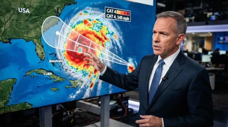
The study, published in the journal Weather, Climate, and Society, evaluated an experimental graphic introduced in 2024. This new version of the traditional hurricane cone was designed to provide a more comprehensive view of hazards by incorporating inland hurricane and tropical storm watches and warnings. While the research confirmed that the public can more easily identify which specific inland areas are under watch, this increased recognition of 'where' a storm might strike did not translate into an increased sense of urgency or a stronger commitment to emergency preparedness among the participants.
The 'Cone of Uncertainty' Misconception
A major focus of the research was the persistent misunderstanding of the iconic 'cone of uncertainty.' For many, the visual width of the cone is interpreted as a direct indicator of the physical size or intensity of a hurricane rather than its intended purpose: to illustrate the uncertainty of the storm's projected path. This fundamental cognitive hurdle remains a significant barrier, as even updated graphical formats fail to correct this long-held misconception.
The research team found that participants who viewed the experimental maps were no more likely to believe the storm presented a severe danger than those viewing traditional maps. This suggests that the visual language of the cone itself may be so deeply ingrained—and so often misinterpreted—that simply adding more data layers to the existing design is insufficient for changing human behavior in high-stakes, life-threatening scenarios.
Why Better Maps Aren't Enough
The core of the issue lies in the bridge between scientific data and public communication. The researchers emphasize that their study does not call into question the meteorology behind the NHC's forecasts; rather, it highlights a disconnect in information design. The goal of emergency communication is not just to provide data, but to effectively translate that data into an actionable narrative that empowers residents to protect their lives and property.
Why it Matters
- Beyond the Coast: The updated graphics aimed to remind inland residents that storm impacts, such as flooding and tornadoes, are not limited to shoreline evacuation zones.
- Cognitive Dissonance: Recognizing a warning does not automatically trigger a behavioral change if the recipient does not perceive the threat level as personally relevant.
- Communication Limits: The findings demonstrate that complex meteorological information requires more than just visual updates to become a catalyst for public safety.
Ultimately, the experts recommend that residents should not rely on a single forecast image to make life-saving decisions. Instead, the most effective approach is to supplement the cone graphic with localized weather reports and direct, actionable advice on expected impacts. By moving away from a reliance on single-image communication, citizens can gain a more accurate understanding of the risks specific to their own communities.