
A Discovery from the Clouds
In a triumph for citizen science, a Canadian amateur astronomer has identified a massive, 25-kilometer-wide impact crater hidden in the remote wilds of Quebec. Joël Lapointe, who was scouting the Côte-Nord region for a future camping trip in 2024, noticed a peculiar, near-perfect circle while scanning online satellite imagery near Lake Marsal. His intuition that the depression might be more than just a standard geographical feature led him to contact planetary experts, eventually sparking a major geological investigation that would confirm the site as a significant ancient impact structure.
While Earth is home to roughly 200 confirmed impact craters, experts estimate that hundreds more remain buried or obscured by time and vegetation. Lapointe’s discovery, now dubbed the Uhackatik structure, represents the most substantial impact crater identified since the 31-kilometer Hiawatha crater was mapped in 2018. The site is currently awaiting formal ratification from the Meteoritical Society, though the scientific community has largely accepted the evidence.
The Grueling Expedition to Uhackatik
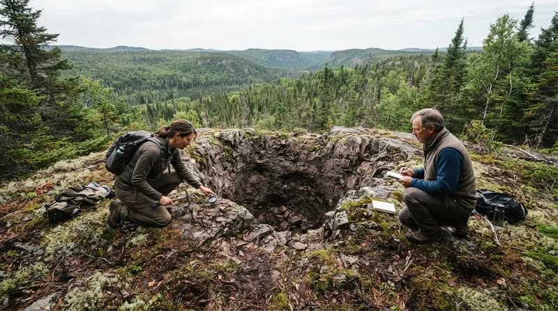
The transition from a satellite map to a verified geological site required a high-stakes expedition. Gordon Osinski, a planetary geologist from Western University and director of the Impact Earth database, led a team into the Quebec wilderness in October 2025. The journey was notoriously difficult, requiring the team to fly in via floatplane and wade through 50 meters of icy, swampy water just to reach the site. Osinski, a seasoned field researcher with experience across six continents, noted that the region’s dense, "gnarly" vegetation and rugged terrain made it one of the most challenging environments he has ever navigated.
Previous surveys of the area had misinterpreted the local rock formations, specifically the breccia, as signs of a diatreme—a volcanic funnel formed by explosive magma. However, the expedition team quickly pivoted their understanding by the second day of their trek. The presence of shatter cones—distinctive, cone-shaped rock fractures created only under the extreme, instantaneous pressures of a high-velocity impact—provided definitive proof that the site was born from a celestial collision rather than volcanic activity.
Why it Matters
The confirmation of the Uhackatik crater offers a rare window into Earth's distant past. Dated to approximately 390 million years ago, the impact occurred well before the major spike in Earth's cratering rate, which some researchers link to asteroid belt collisions. If an object of that size were to strike the same region today, the results would be catastrophic, causing regional devastation and widespread global climate disruptions.
- Diameter: 25 kilometers (approximately 16 miles).
- Estimated Age: 390 million years.
- Key Diagnostic Feature: Shatter cones found in local rock outcrops.
- Naming: Named 'Uhackatik' following consultation with the Innu Council of Ekuanitshit.
The Future of Citizen Science
While Uhackatik is far too remote for practical use as an astronaut training ground, the discovery highlights the incredible potential of everyday individuals to contribute to rigorous scientific research. Tools like public-access satellite imagery allow citizen scientists to spot anomalies that professional researchers might otherwise miss due to the sheer scale of the planet. NASA continues to encourage this engagement through initiatives like the Daily Minor Planet project, which tasks volunteers with identifying potential asteroid threats, and the Impact Flash program, which monitors the moon for signs of meteoroid strikes. Lapointe’s experience serves as a powerful reminder: whether you are an expert or an enthusiast, there is still an immense amount of the world—and our history—waiting to be uncovered.