A New Era of In-Car Visualization
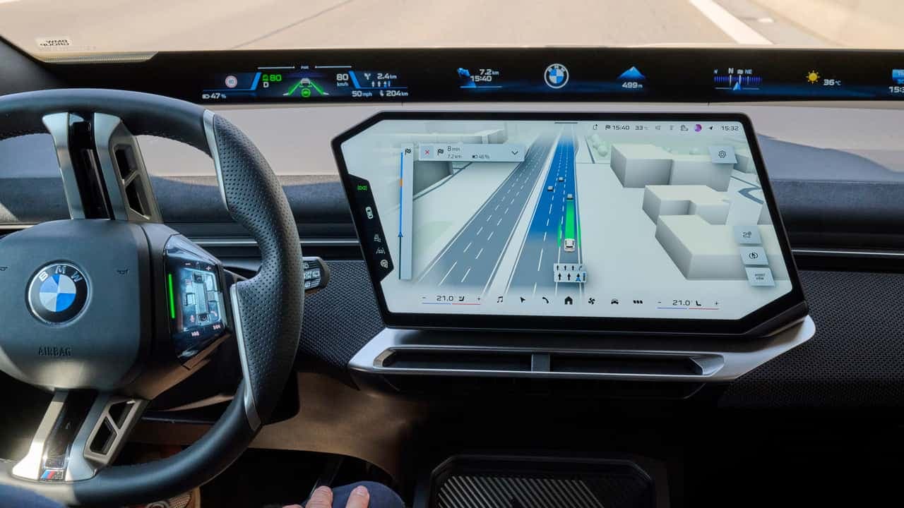
BMW is officially elevating the in-car experience for its latest electric fleet by introducing a significant update to its native navigation software. Starting next month, vehicles operating on the BMW Operating System X—most notably the new iX3—will receive a comprehensive redesign of the BMW Maps application. This update is designed to move beyond the traditional 2D map, creating a unified digital environment that merges route guidance with real-time telemetry from the vehicle’s active safety suite.
By shifting to a 3D interface, BMW is effectively bridging the gap between standard GPS functionality and the advanced situational awareness demanded by modern semi-automated driving systems. The result is a dashboard that provides a clear, real-time digital twin of the vehicle’s immediate surroundings. This allows drivers to see their car positioned accurately within its lane, alongside depictions of neighboring traffic and upcoming navigation maneuvers, providing a visual shorthand that makes high-speed highway driving and complex city navigation significantly more digestible.
Why It Matters: Bridging the Gap to Automation
The introduction of this 3D interface is not merely an aesthetic choice; it serves as a critical bridge toward the company's long-term autonomy roadmap. With the automaker aiming to deploy advanced navigation-guided, semi-automated driving in urban centers throughout Germany by 2027—and subsequently other global markets—the ability for a driver to intuitively understand what the car 'sees' is paramount. By visualizing the inputs of systems like Highway Assistant, the driver can monitor the car’s decision-making process with greater confidence.
- Unified Interface: Consolidates route guidance, 3D environment rendering, and driver assistance status into a single view.
- Technological Backbone: Developed in-house but powered by high-fidelity navigation data from Mapbox.
- Strategic Roadmap: Prepares the UI for the 2027 rollout of urban automated driving features.
- Hardware Compatibility: Debuting on the iX3, with subsequent updates planned for the i3, iX5, and the facelifted i7.
Refined Real-Time Awareness
At the core of this update is the integration of Mapbox technology, which provides the granular detail needed for the 3D view to function reliably. Unlike standard maps that only show the geometry of a road, this system utilizes data regarding lane markers, landmarks, and physical environmental constraints. This ensures that the 3D projection on the central display matches the physical world as seen through the vehicle’s cameras and sensors, effectively creating a feedback loop between the driver and the car’s Highway Assistant 2 system.
For current users, this means the Highway Assistant—which allows for hands-free operation on specific highway stretches at speeds of up to 80 mph (130 km/h)—is no longer a 'black box.' The visualization clearly articulates when the car has identified the lane lines and surrounding objects, reinforcing the driver's trust in the vehicle’s automated maneuvers. As this software scales across the Neue Klasse architecture, it cements BMW’s commitment to a software-defined vehicle strategy where the user interface is just as vital as the battery or the electric motors under the hood.