The New Frontier of Ecological Monitoring
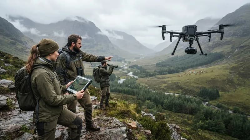
Conservation science is undergoing a quiet technological revolution, shifting from ground-based observation to high-tech aerial surveillance. By integrating sophisticated drone hardware with machine learning algorithms, researchers are now able to monitor endangered populations in environments that were previously inaccessible or too vast to survey manually. This interdisciplinary approach, spearheaded by projects like WildDrone and WildBotics, allows conservationists to gather high-fidelity data on population dynamics, behavior, and habitat health without disrupting the natural environment.
The shift is not just about convenience; it is about precision. Aerial robotics equipped with thermal sensors and high-resolution cameras provide a bird's-eye view that allows scientists to count animals, detect illegal poaching activities, and monitor the migration patterns of elusive species in real time. This marriage of physical robotics and advanced computing power is creating a new blueprint for wildlife management, turning vast, complex ecosystems into measurable, data-driven landscapes.
Real-Time Data and Species Protection
One of the most significant advancements lies in the ability to collect granular data on animal physiology from the air. Researchers like Camille Rondeau Saint-Jean are pushing the limits of drone technology by utilizing aerial platforms to track physical body data from wildlife. These real-time diagnostics offer unprecedented insights into the health of individual animals, enabling scientists to intervene or adjust conservation strategies before a local population reaches a breaking point.
However, the transition to tech-forward conservation is not without its hurdles. Experts like William Njoroge, operating at Kenya’s Ol Pejeta Conservancy—home to the world’s last two northern white rhinos—highlight the practical challenges of deploying these systems. From navigating the complex regulatory landscape of airspace control to dealing with the harsh technical constraints of remote, off-grid deployments, integrating drones with traditional ranger-led monitoring requires both innovation and resilience.
Why It Matters
- Scalability: Drones can cover ground in hours that would take human teams weeks to traverse on foot, effectively multiplying the reach of limited conservation staffing.
- Non-Invasive Research: Aerial monitoring significantly reduces the stress on animals, as robots can observe from distances and altitudes that do not trigger flight or defensive responses.
- Interdisciplinary Success: The success of these initiatives proves that combining physics, robotics, and classical biology provides the most robust toolkit for addressing the global biodiversity crisis.
Ultimately, the fusion of machine learning with aerial robotics acts as a force multiplier for conservation sites. As these technologies become more accessible and autonomous, the ability to protect endangered species will move from reactive crisis management to a proactive, predictive model that preserves biodiversity for the future.