
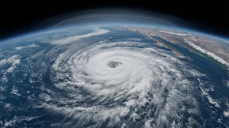
The Anatomy of an Atmospheric Ripple
As Hurricane Simon churned through the Pacific in mid-October 2026, it did more than just threaten coastal communities with wind and rain. Far above the storm’s chaotic eyewall, specialized sensors aboard NASA satellites recorded a rare scientific spectacle: massive atmospheric gravity waves. These waves, which are typically invisible to the naked eye, acted as a ripple effect throughout the upper reaches of our atmosphere, triggered by the sheer intensity of the tropical cyclone below.
The generation of these waves is tied to the internal thermodynamics of the storm. Near the core of a powerful hurricane, intense convective activity forces warm, moisture-laden air to surge upward at extreme velocities, creating towering cumulonimbus clouds. When these powerful updrafts collide with the surrounding air, they create oscillations—atmospheric gravity waves—that propagate upward into the stratosphere and mesosphere. Essentially, the storm acts as a massive physical disturbance that sends shockwaves deep into the upper atmosphere, using gravity as the restoring force to propagate the motion.
Why We Can See the Invisible
Under standard conditions, these atmospheric ripples remain hidden from our view. However, a specific set of circumstances allowed NASA’s VIIRS instrument to document them. These waves manifest visually by passing through "airglow," a faint natural light produced by gases in the upper atmosphere. As the gravity waves traverse this region, they create subtle fluctuations in brightness, revealing their structure.
Capturing this phenomenon required a perfect alignment of technology and environment. Because the VIIRS day-night band is sensitive enough to detect this faint light, it can map these ripples, but only if ambient light pollution—like moonlight—is sufficiently low. During the observation of Hurricane Simon, the lack of moonlight provided the necessary contrast for the sensors to isolate these atmospheric signatures against the dark backdrop of the planet. This rare visual confirmation offers scientists a unique window into how severe weather systems interact with the upper atmosphere.
The Broader Impact of Tropical Cyclones
Beyond the scientific intrigue of gravity waves, Hurricane Simon served as a stark reminder of the unpredictability inherent in modern weather systems. Moving dangerously close to Mexico’s Pacific coast with wind speeds peaking at 250 kilometers per hour, the Category 4 storm forced evacuations and brought torrential rains. The rugged topography of the Sierra Madre mountains eventually played a key role in tempering the storm's intensity, illustrating how local geography can influence cyclone behavior.
As meteorologists continue to grapple with shifting weather patterns, the ability to monitor these atmospheric disturbances is becoming increasingly vital. These ripples serve as indicators of the raw energy contained within a storm, offering data points that could eventually improve the precision of hurricane forecasting. Whether through physical landfall threats or the invisible waves sent into space, Hurricane Simon underscored the far-reaching influence that a single tropical system can exert on the Earth's environment.